|
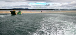
Lasciata Brisbane, ci imbarchiamo sul
traghetto per Fraser Island,
la più grande isola di sabbia del mondo
The barge
to Fraser Island,
the biggest sand bar in the world |
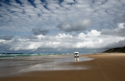
A Fraser
Island si corre (soprattutto) sulla spiaggia, quando la marea non è
troppo alta
There are
no roads in Fraser Island, so vehicles move mostly along the beach |
|
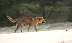
Un dingo a Fraser Island
A dingo |
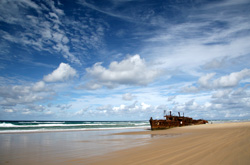
Il relitto della nave "Maheno",
"spiaggiata" a Fraser Island nel 1935
The wreck
of the "Maheno"... |
|
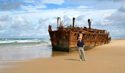
Rottami vari a
Fraser Island
... shipwrecked in 1935
on its
way to Japan |
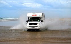
Guado dell'Ely Creek, prima dell'alta
marea
Crossing Ely Creek, just before
the
high tide makes it impassable |
|
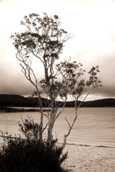
Lake Birrabeen a Fraser Island
Lake Birrabeen, one of the fresh
water lakes of Fraser Island |
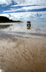
Persi tra il cielo e l'oceano
Lost between the sky and the ocean |
|
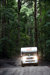
Non solo dune di sabbia spazzate
battute
dal vento, ma anche grandi foreste...
There are also ancient forests |
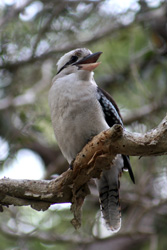
Si sentono grandi risate...
sono i Kookaburra
If you hear someone laughing
...
it's a kookaburra! |
|
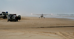
Oggi a Fraser Island la pista
costiera
è un po' trafficata
(gli aerei hanno comunque la precedenza)
Planes also land on the beach |
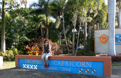
Vacanza ai Tropici...
Crossing the Tropic of Capricorn |
|
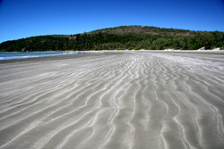
Cape Hillsborough National Park
|
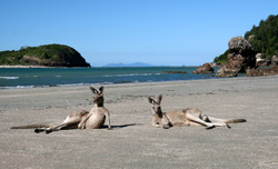
Vita da spiaggia a Cape Hillsborough
Beach bums at Cape Hillsborough |
|
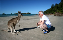
Ci siamo già visti da qualche parte?
Hey mate, aren't you ugly!
|
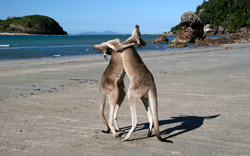
Danza rituale
(?)
Dancing wallabies |
|
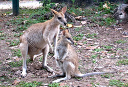
Wallabies a Cape Hillsborough
A mother with her young |
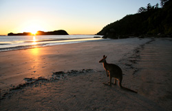
Alba sulla spiaggia ...
non siamo i
soli ad ammirarla!
Admiring the sunrise on the
beach |
|
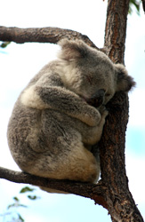
Koala... dormiglione a Magnetic
Island
Koalas sleep 20 hours a day |
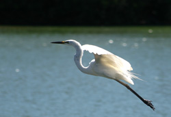
Airone australiano
A heron taking off |
|
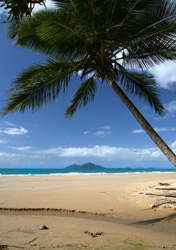
Mission Beach
|
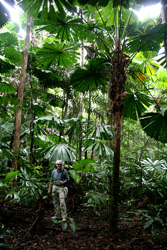
La foresta tropicale a Cape
Tribulation
Rainforest at Cape Tribulation |
|
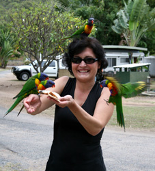
A Venezia i piccioni... qui i Rainbow
Lorikeets
No pigeons here - but
colourful
Rainbow Lorikeets |
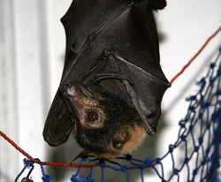
Una volpe volante ferita in cura al
centro
di recupero di Cape Tribulation
A fruit bat recovering at
the Bat House
at Cape Tribulation |
|
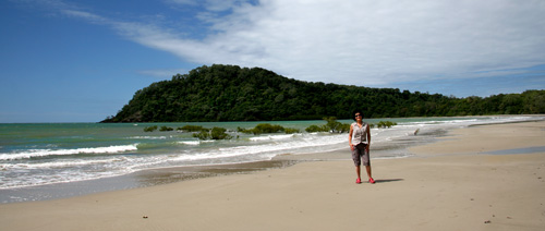
Cape Tribulation, così denominato dal
capitano James Cook il giorno 10 giugno 1770,
che rischiò di perdere la sua nave Endeavour per un urto contro la
barriera corallina.
Cape Tribulation was named by British
navigator Lt. James Cook on the 10th of June 1770
after his ship hit a reef as it passed over it, north east of the
cape, at 6pm.
This made Cook pull away from the coast, looking for deeper water.
At 10.30pm, the Endeavour hit a reef almost sinking Cook's ship,
on what is now named Endeavour Reef. Cook recorded "...the north
point [was named]
Cape Tribulation because here began
all our troubles". |
|
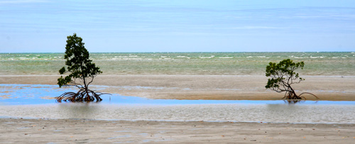
Lungo il Bloomfield Track, a nord di
Cape Tribulation
Along Bloomfield track, north of Cape
Tribulation |
|
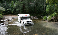
Indispensabili le 4 ruote motrici...
You don't go far without 4-wheel
drive.. |
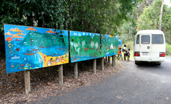
Lo school bus della comunità
aborigena
di Wujal Wujal
The schoolbus of the Aboriginal
community
of Wujal Wujal |
|
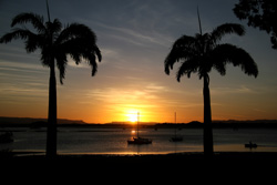
Tramonto a Cooktown
Sunset in Cooktown |
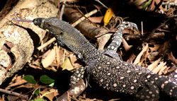
Un goanna prende il sole nel
giardino botanico di Cooktown
A goanna basking in the sun in
Cooktown Botanical Gardens |
|
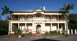
Cooktown.
La cittadina prende il nome dal capitano James Cook, che nel giugno
1770 dovette fermarsi per sette settimane nella baia per riparare le
falle dell'Endeavour. Oggi il fiume, che offrì un sicuro riparo alla
spedizione, si chiama, per l'appunto, Endeavour River
A colonial building in
Cooktown; the town is named after Captain James Cook, who arrived in
the area in June 1770 and reamained for seven weeks while his ship,
the Endeavour, was being repaired. |
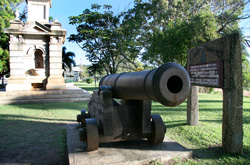
Questo cannone, dotato di tre (!)
proiettili, avrebbe dovuto
proteggere un paio di secoli
fa la città da una ipotetica
invasione... russa.
Cosa non si inventano per
spaventare i sudditi...
This cannon, together with three
balls,
was meant to protect the town
from a Russian invasion ... |
|
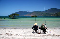
Questa è vita... ad Archer Point
Beach life at Archer Point |
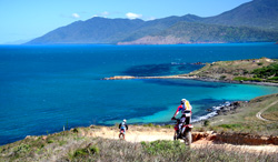
Archer Point si trova poco a sud di
Cooktown
Archer Point is just south of
Cooktown |
|
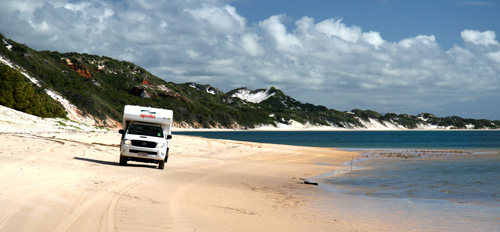
Le spiagge della comunità aborigena
di Hope Vale.
I visitatori non sono particolarmente bene accetti: non ci sono
cartelli o
segnalazioni di sorta per arrivare e la pista è inoltre abbastanza
impegnativa.
Le comunità aborigene della zona sono state vessate in ogni modo e
espropriate
dei terreni migliori a partire principalmente dalla corsa all'oro
iniziata nel 1872:
si può comprendere facilmente la poca simpatia per i bianchi...
This beach belongs to the Aboriginal
community of Hope Vale.
Getting there is not particularly easy, as there is only a track
among
the dunes and no street signs! |
|
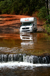
Ancora in direzione nord...
Northbound... |
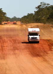
... verso Lakeland National Park
... towards Lakeland National
Park |
|
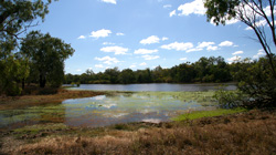
Uno dei laghi di Lakeland Nationa
Park
One of the croc-infested ponds
of
Lakeland National Park |
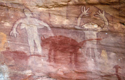
Pitture rupestri presso Laura
Rock Art near Laura |
|
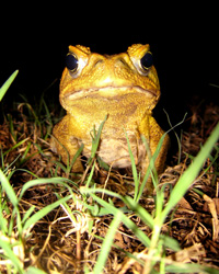
Incontri... notturni
Nocturnal encounters |
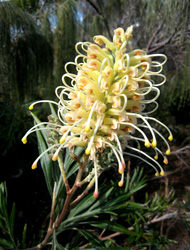
Anche la flora australiana è
assolutamente originale
Australian plants are unique |
|
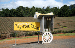
Una piantagione di tè negli altopiani
di Atherton
A tea plantation on Atherton
Tablelands |
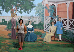
Quadro familiare
Family picture |
|
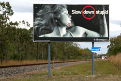
Campagna shock
per la sicurezza
stradale
Drive safely! |
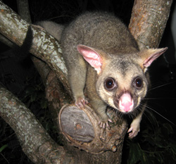
Un opossum in cerca di frutta...
A visit from a possum |
|
Photos ©
Nicoletta Galante 2010
|